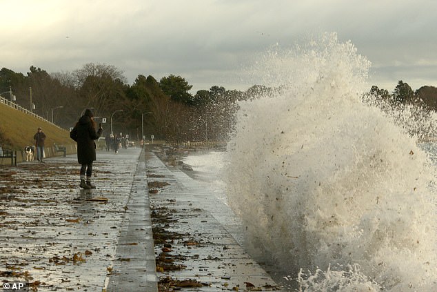
A ‘once in a decade’ bomb cyclone has unleashed itself on several West Coast states, leaving hundreds of thousands of Americans without power and two dead.
The Weather Prediction Center issued excessive rainfall risks through Friday, and hurricane-force wind warnings in effect as a result of this storm and the strongest atmospheric river that California and the Pacific Northwest have seen this season.
The bomb cyclone – so called because of its rapid intensification Tuesday – and has already caused significant damage as it moves toward Washington, Oregon and northern California.
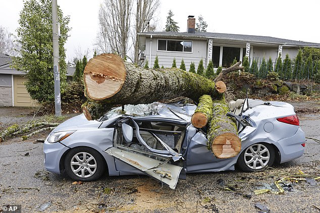
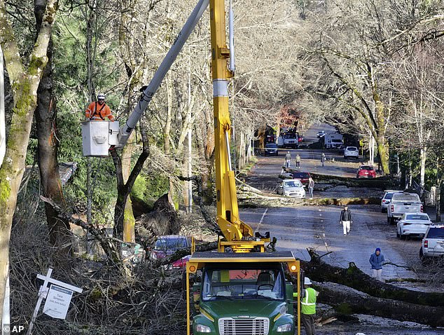
Falling trees struck homes and littered roads across northwest Washington.
In Lynnwood, a woman died Tuesday night when a large tree fell on a homeless encampment, South County Fire said in a statement.
In Bellevue, east of Seattle, a tree fell onto a home, killing a woman Tuesday night, fire officials said.
While Meteorologists are expecting the eye of the storm to remain over the ocean, major hurricane-force conditions, including wind gusts between 72 and 77 mph, will continue to batter the states this week.
The National Weather Service (NWS) office in Portland said: ‘Extremely strong winds and very steep and mountainous seas will likely capsize or damage vessels. Near zero visibility is expected. Bars will become impassable.

‘Mariners should remain in port, alter course, and/or secure the vessel for extreme winds and very steep seas.’
The number of power outage reports in Washington fluctuated wildly Tuesday evening, but steadily declined to about 500,000 by Wednesday morning, according to poweroutage.us.
About 2,800 customers were reported to be without power Wednesday in Oregon, 41,000 in California and 12,000 around Carson City and Reno, Nevada.
Semi-trucks were prohibited on the main highway between the two cities due to high winds. All chairlifts were shut down at the Mt. Rose Ski Resort near Lake Tahoe.
Three Reno schools were closed, and more than a dozen schools were closed in Seattle alone.
The weather service warned people on the West Coast about the danger of trees during high winds, posting on X, ‘Stay safe by avoiding exterior rooms and windows and by using caution when driving.’
In Seattle, a falling tree struck a vehicle, temporarily trapping the driver inside, according to the Seattle Fire Department. The individual is reportedly in a stable condition.
An Amtrak train also collided with a fallen tree near an intersection in Stanwood, north of Seattle on Tuesday night, according to CNN affiliate KIRO.


None of the 47 passengers on board were injured, but the crash left the train inoperable.
Meteorologists called this the first major storm of the winter season, and its impact will be felt through the weekend even as the bomb cyclone and atmospheric river stall along the coast as the week progresses.
A live tracker revealed the bomb cyclone’s deadly location sat just 300 miles off the coast of Washington at 9am ET and was slowly inching closer to the shoreline.
As of 8pm ET Tuesday, the peak wind speed was in Canadian waters, where gusts of 101 mph were reported off the coast of Vancouver Island, according to the NWS in Seattle.
The atmospheric river made landfall in northern California Tuesday night, and is expected to drop 10 to 20 inches of rain in California’s northern Coast Ranges and very heavy snow in the Klamath Mountains.
Peak impacts from the atmospheric river will hammer northern California through Friday, potentially triggering deadly flash floods, mudslides and rockslides.
But the system is expected to weaken as it moves over the Cascades and through to northern California and southwest Oregon by Friday.
‘It’s severe out there. Trees are coming down all over the city, with multiple falling onto homes,’ the fire department in Bellevue, east of Seattle, posted in a Severe Weather Safety alert on Facebook.
‘If you are able, head to the lowest floor you can and stay away from windows. Do not go outside if you can avoid it.’


The storm is considered a ‘bomb’ cyclone because it lost more than 24 millibars of central pressure over a 24-hour period. This level of strengthening is known as ‘bombogenesis.’
Storm intensity is measured by central pressure – the lower the pressure, the stronger the impact.
On Tuesday evening, a buoy off the coast of Washington located near the storm’s center recorded an air pressure of 950 millibars with wind gusts of 74 mph, Washington Post meteorologist Ben Noll reported.
A sea-level pressure less than 980 millibars represents a pretty strong low, according to the Penn State College of Earth and Mineral Sciences.
The bomb cyclone is combining forces with an atmospheric river – a long and narrow region of the atmosphere that carries warmth and moisture from the tropics toward the Earth’s poles.


This will significantly amplify the amount of precipitation dropped over the region, especially in California.
AccuWeather Senior Meteorologist Heather Zehr said: ‘Soaking rain from the storm will reach the San Francisco Bay area but not until later in the week.’
‘The heaviest rain will fall near and north of the North Bay and up along the coast of Northern California while San Francisco and the South Bay will be in the zone where rainfall will diminish quickly from north to south.’
This area could see up to 20 inches of total rainfall, meteorologists predict.

Flash floods, mudslides and rockslides could result, especially in areas impacted by burn scars, or charred, barren patches of land left behind by wildfire.
That is because burned soil can be as water-repellant as pavement, according to the National Oceanic and Atmospheric Administration (NOAA), and wildfire destroys vegetation that stabilizes soils.
The National Weather Service has also issued a flood watch for parts of southwestern Oregon through Friday evening, while rough winds and seas halted a ferry route in northwestern Washington between Port Townsend and Coupeville.
A blizzard warning was issued for the majority of the Cascades in Washington, including Mount Rainier National Park, starting Tuesday afternoon, with up to a foot of snow and wind gusts up to 60 mph, according to the weather service in Seattle.
While California, Oregon and Washington will continue to see the brunt of the impacts, storm conditions are already stretching beyond their borders, with heavy snowfall extending into Idaho, Montana, Alberta and Saskatchewan.

