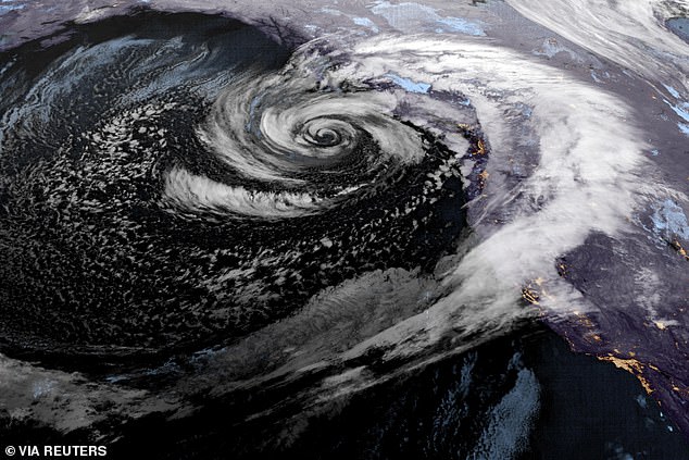
Washington residents woke up up to devastation wrought by a deadly bomb cyclone after the storm battered the state Tuesday and Wednesday.
The record-breaking storm swirled with hurricane-force intensity off the West Coast this week, generating up to 74 mph gusts that downed trees, powerlines and killed at least two people.
Two women lost their lives in tree-related accidents Tuesday evening – one in a homeless encampment in Lynnwood and the other in the Bridal Trails neighborhood of Bellevue.
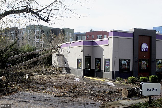
Numerous homes and cars have been crushed by falling trees, in some cases leaving people trapped inside until emergency responders could free them.
Crews have been working tirelessly to clear roadways of debris.
On Wednesday, crews in western Washington were working to restore electricity to the more than 600,000 customers who lost power overnight.
As of 9am ET Thursday, more than 300,000 are still experiencing outages, according to PowerOutage.us.
‘We haven’t had a storm like this since January of 2012,’ said Mary Kipp, president of Puget Sound Energy, which serves over 1.2 million electric customers in the state.
She said on Thursday that it would be at least a few days for full restoration.
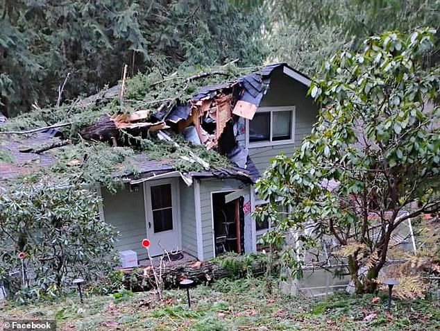
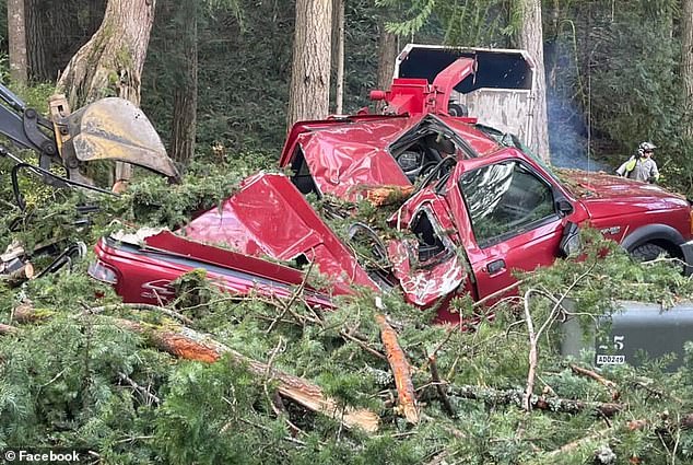
Residents of Sudden Valley took to social media to share photos of damage in their community. Trees fell onto several homes, a propane tank and a pickup truck.
One photo posted on the Whatcom County Weather Facebook page showed the roof of a Sudden Valley home significantly caved in and covered in downed branches.
And a crushed red pickup truck was seen under a mound of trees and branches, appearing like a pile of scrap metal, as the entire bed and much of the cabin took significant damage.
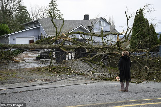
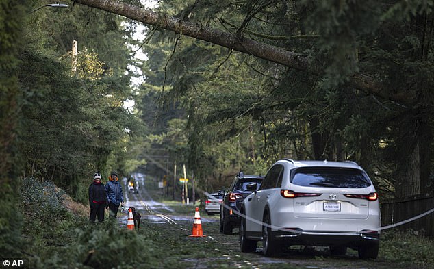
Tracy Meloy of Issaquah, Washington stepped out of her home Wednesday morning and found her neighborhood in shambles, the Associated Press reported.
‘Now that I’m standing here in front of the house, I can tell it’s the tree that was across the street,’ she said.
The tree took powerlines down with it as it fell, and branches and leaves were strewn across the road.
‘It looks like a forest floor instead of a street,’ she said.
In Seattle, one resident became trapped inside their vehicle when a tree fell onto the car. The Seattle Fire Department later reported that the person was in stable condition.
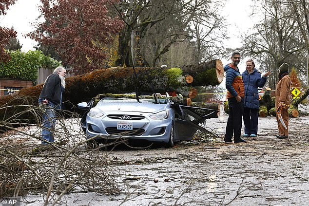
Tiffani Palpong, a Lake Stevens resident, stood in front of her home where her 20 year-old son, Logan, was trapped inside by downed power lines and trees on Wednesday.
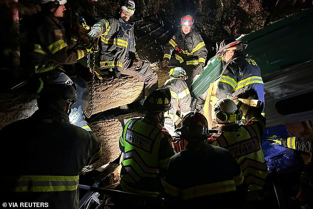
And in Maple Valley, firefighters responded to a call about two people trapped inside a trailer on Tuesday, using chains and headlamps to try and move the fallen tree in the dead of night.
Across Puget Sound, downed trees are affecting road transportation, and commuters have been advised to give themselves extra time to reach their destinations.
State Route 18 is closed in Issaquah between Interstate 90 and Issaquah-Hobart road. Officials have not stated when they expect the road to reopen.
More than a dozen schools closed in Seattle on Wednesday, with Issaquah, Renton and Bellevue school districts opting to remain shut Thursday as storm cleanup efforts and power outages persist.
On Wednesday night, the US Coast Guard announced that river bar crossings to the ocean would be closed Quillayute River in Washington to Humboldt Bay in California.
Seattle-area residents reported widespread cellular outages for Verizon, T-Mobile and AT&T.
Seattle area Weather Radio remains off air until further notice, as well as the Puget Sound Marine transmitter, as technicians are unable to reach the site for repairs due to downed trees and power lines.
While the bomb cyclone has shifted north, its center now located off the coast of Vancouver Island, Washington isn’t out of the woods yet.
Several National Weather Service (NWS) advisories and watches remain in effect for the Evergreen State.
Those include a Winter Weather Advisory in the Northeast Mountains through 1pm Thursday, a High Wind Watch along the South Washington Coast through 1am Saturday, and a Flood Watch in Mason County through 7am Saturday.
These notices have been issued in advance of a Category 5 atmospheric river that the bomb cyclone has fueled and directed toward the West Coast.
This band of atmospheric moisture made landfall Tuesday and is expected to deliver peak impacts Thursday, drenching the Pacific Northwest and northern California with up to 20 inches of rain and dumping feet of snow at high elevations.
This storm system is already pummeling the region. Meteorologist predict its impact will persist through the end of the week, especially as a second offshore storm reinforces its strength.
Though Washington weathered the most intense storm impacts from the bomb cyclone, California and Oregon were also in the line of fire.
Due to the path of the atmospheric river, these two states will see the most severe storm conditions going forward – especially northern California and southwestern Oregon.
The heaviest precipitation is currently battering northern California.
Up to 16 inches of rain is expected in northern California and southwestern Oregon through Friday.
By Wednesday evening, parts of this region were receiving torrential rainfall. Santa Rosa saw about five inches within 24 hours, Marc Chenard, a meteorologist with the NWS.
This will likely result in flooding in poor drainage areas and areas affected by burn scars, or charred, barren patches of land left behind by wildfire.
That is because burned soil can be as water-repellant as pavement, according to the National Oceanic and Atmospheric Administration (NOAA).
There will also be a high risk of mudslides and rockslides in areas affected by wildfire, as the loss of vegetation leaves soils volatile and easily erodible.
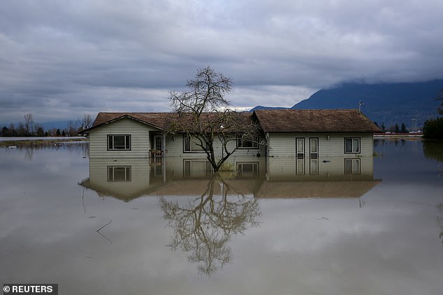
About a dozen small landslides have already struck in northern California in the last 24 hours, including one on Highway 281 on Wednesday morning that caused a vehicle crash, Chenard said.
‘A rare high-risk excessive rainfall outlook has been issued by NOAA’s Weather Prediction Center in northwest California through Thursday night, including Eureka, because of how serious the flood threat could be in that area,’ The Weather Channel reported.
‘Elsewhere, lighter amounts of additional rain can be expected in western Oregon and western Washington going forward, with the heaviest amounts in coastal and foothill locations.’
Heavy mountain snowfall will also continue across northern California and Oregon Cascades through early Thursday. Already, more than a foot has accumulated in parts of the Cascade Mountains and in California.
Whiteout conditions brought traffic to a standstill on Interstate 5 north of the town of Weed, California Wednesday afternoon.
‘I-5 S/B at Edgewood (Yreka) is currently closed due to severe weather conditions. Chain requirements are active at several locations throughout Northern California,’ the California Highway Patrol Northern Division posted on X Wednesday.
This is the strongest atmospheric river that the Pacific Northwest has seen this season.
The bomb cyclone also achieved record-strength Tuesday, with a central pressure equivalent to that of a major hurricane.
Climate change is fueling storm systems like this bomb cyclone and atmospheric river, making them larger, stronger and more hazardous, according to the Union of Concerned Scientists.

