Spain has been battered by devastating rain and floods over the past two weeks, with the country’s wet weather season wreaking havoc on communities along the Mediterranean coast.
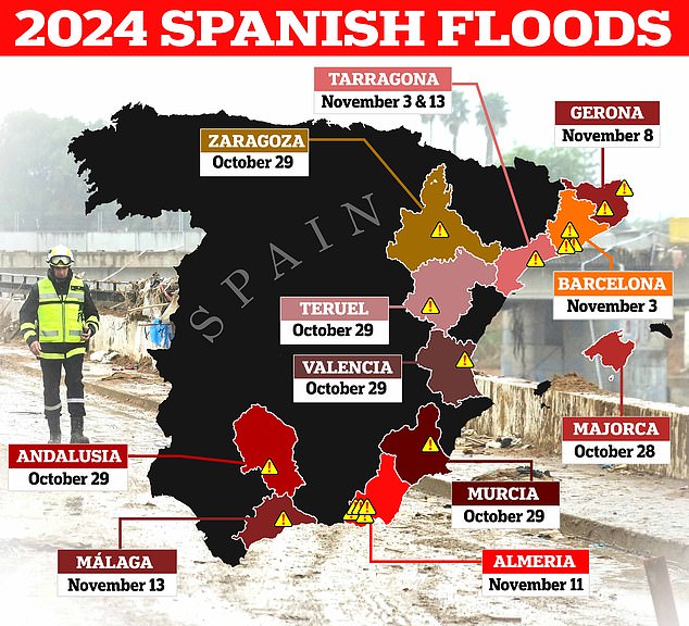
A new map lays bare the timeline of where the catastrophic rainfall has hit and the deadly flash floods it has triggered, as region after region was affected by relentless weather fronts.
The worst impact of heavy rain was felt on October 29, when more than a year’s worth of precipitation was dumped on areas in southern and eastern Spain, with the Valencia region among the hardest hit as locals said warnings came too late.
Flash floods in Valencia and other parts of the country have since killed more than 220 people, destroyed thousands of homes and triggered mass protests against regional authorities.
The extreme weather has continued to grip large swathes of the country this week, with thousands evacuated from their homes in the Malaga region and much of the country still on alert as the stormy weather shows little sign of letting up.
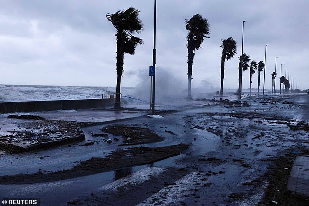


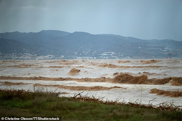
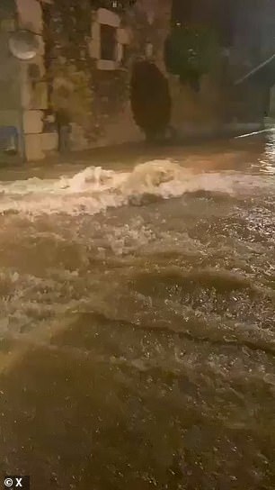
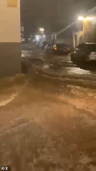
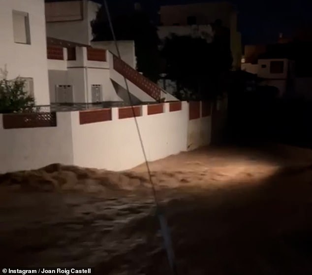
A red weather alert was in place for the whole of Malaga province yesterday, with pictures and videos showing water sweeping through towns and popular coastal resorts including Marbella and Estepona.
Pictures from Malaga city showed submerged cars and abandoned buses and sticks and other objects accumulating at the bottom of streets, which had been turned to rivers by the heavy rain.
Meanwhile Valencia has been bracing for another onslaught as coastal areas were put on the highest alert on Wednesday night, with forecasters warning that up to 180 millimetres (7 inches) of rain could fall within five hours.
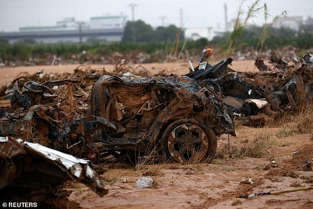
More than two weeks after the region first fell victim to the floods, large areas remain covered in mud and debris, with more rainfall making the situation even more dire for clean-up volunteers and rescue workers, who are still combing some areas for bodies.
The most up to date reports indicate that 223 people lost their lives, with at least 31 still missing, making it Spain’s deadliest weather disaster in decades.
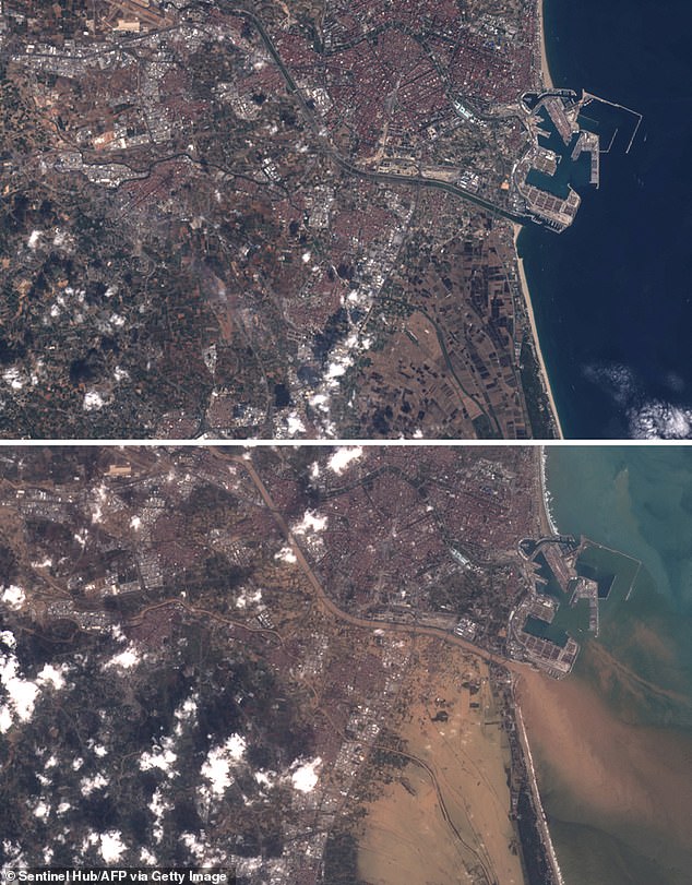
The emergency response included the deployment of over 2,000 personnel from Spain’s military emergency unit, who worked alongside local responders and volunteers to conduct rescue and recovery operations.
An additional number of more than 30,000 volunteers have been mobilized, from all over the country, to support the ongoing cleanup efforts.
To date, hundreds of families have lost their homes and thousands have seen their vehicles destroyed.
Military vehicles have been patrolling the area to offer aid and have been supplying people with food and other necessities.
Numerous homes and public spaces were submerged, and up to 155,000 households experienced power outages.
The regions of Aragon, Murcia and Andalusia were also impacted by flooding on October 29, with a 71-year-old British ex-pat killed at his home in Malaga.
As many parts of the country reeled from the first wave of floods, the Balearic Islands and Catalonia were put on alert for severe rain.
Spain’s weather service issued a red alert for ‘continuous and torrential rains’ along the Barcelona coast, telling people to stay alert and not travel ‘unless strictly necessary’.
Roads were blocked by mudslides and high water, with motorists filmed driving through submerged streets, while Barcelona’s El Prat airport was also closed as the terminal building filled with water.
Treacherous conditions have continued to hit the nearby area of Tarragona this week.
Spain’s weather service AEMET renewed its warnings yesterday, saying on X that ‘very torrential rain and showers’ would be hitting Malaga, Granada, Tarragona and the coast of Valencia once again.
Thousands of people were evacuated from homes and holiday apartments on the Costa del Sol after a weather alert for the area went from yellow to red and locals and holidaymakers were warned of an ‘extreme risk.’

The phenomenon behind the unrelenting barrage of rain is known locally as DANA, a Spanish acronym for high-altitude isolated depression.
Unlike common storms or squalls it can form independently of polar or subtropical jet streams.
When cold air blows over warm Mediterranean waters it causes hotter air to rise quickly and form towering, dense, water-laden clouds that can remain over the same area for many hours, raising their destructive potential.
The event sometimes provokes large hail storms and tornadoes, as seen this week, meteorologists say.
Eastern and Southern Spain are particularly susceptible to the phenomenon due to its position between the Atlantic Ocean and the Mediterranean Sea.
Warm, humid air masses and cold fronts meet in a region where mountains favour the formation of storm clouds and rainfall.
Before the term DANA was coined in the early 2000s, any heavy rainfall in the autumn, characteristic of the Mediterranean climate, used to go by the popular name ‘gota fria’ (cold drop) in Spain and parts of France. The term is still widely used colloquially.


Its origin dates back to 1886 when German scientists introduced the idea of ‘kaltlufttropfen’, or cold air drop, to describe high altitude disturbance but without apparent reflection on the surface.
Aemet says the concept of cold drop is outdated and defines DANA as a closed high-altitude depression that has become isolated and separated from an associated jet stream.
Aemet says DANAs sometimes become stationary or even move backwards, from east to west.
Enrico Scoccimarro, senior scientist at the Euro-Mediterranean Center on Climate Change, said last month that while the large water dumps are ‘typical of the western Mediterranean region and of this period of the year’, the recent weather event was ‘exceptional’.
‘Events of this type, in these areas and with this intensity, have not been recorded for several decades, you have to go back to the 1960s to find similar values,’ he told Italian daily newspaper Corriere della Sera.
Scientists are usually cautious of linking individual weather events with climate change, but many have said that a combination of factors linked to it likely caused the dramatic weather event.
Dr Friederike Otto, Lead of World Weather Attribution at the Centre for Environmental Policy, Imperial College London, said: ‘No doubt about it, these explosive downpours were intensified by climate change.
‘With every fraction of a degree of fossil fuel warming, the atmosphere can hold more moisture, leading to heavier bursts of rainfall.
‘These deadly floods are yet another reminder of how dangerous climate change has already become at just 1.3°C of warming.
‘But last week the UN warned that we are on track to experience up to 3.1°C of warming by the end of the century.’
Dr Jess Neumann, Associate Professor of Hydrology at the University of Reading, added: ‘The flash floods in Spain are another terrible reminder of the changing and more chaotic weather we are experiencing as a result of climate change.’
Studies have shown that the Mediterranean region – which is home to more than 510 million people – is warming 20 per cent faster than the global average.
This leaves coastal zones at heightened disaster risks, including flooding and erosion.
Dr Ernesto Rodríguez Camino, Senior State Meteorologist and member of Spanish Meteorological Association, said: ‘In general terms, what we know is that, in the context of climate change, these types of intense and exceptional, rare rainfall events are going to become more frequent and more intense and, therefore, destructive.’
The UN Environment Programme calls the Mediterranean a ‘climate change hotspot’ where vulnerabilities are exacerbated.


