The ‘arctic express’ is set to blast the Eastern US with another round of frigid air this week, sending temperatures plummeting 10 to 20 degrees F below average.
The jetstream will carry a blast of cold air through the Midwest, Northeast and Southeast starting January 15, with some states experiencing temperatures that feel as low as -30F.
However, heavy lake-effect snow — which occurs when cold air moves over the relatively warm surface of a lake — could fall downwind of the Great Lakes, and some snow squalls may hit midwestern and northeastern states.
While the East braces for freezing temperatures, the West Coast is poised for a resurgence of the Santa Ana winds that have triggered deadly wildfires in Southern California.
The winds died down over the weekend, granting firefighters much-needed time to gain some control over three active blazes still scorching the Los Angeles metro area.
But the Palisades and Eaton fires, the two largest and deadliest, are still burning at just 13 and 27 percent containment, respectively.
The hot, dry hurricane-force gusts should return Monday afternoon and persist through Wednesday, reaching speeds of 60 to 100 mph.
The National Weather Service (NWS) issued new fire weather warnings Sunday, warning of a ‘particularly dangerous situation’ for Los Angeles through midweek.
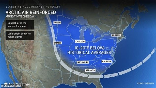
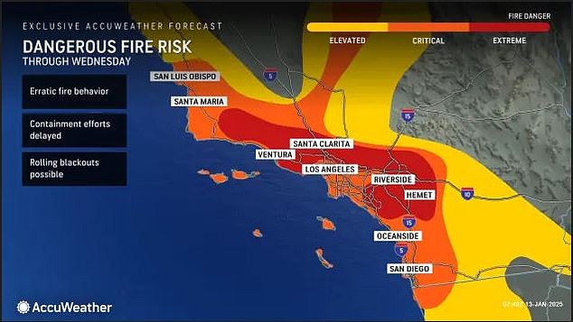
The weather hitting the US is eerily similar to last Monday when the NWS issued alerts for Santa Ana winds and an Arctic blast.
The cold air is set to bring at-or-below-freezing temperatures as far south as Texas, Mississippi and Georgia by Tuesday morning, increasing strain on heating budgets and the risk of frozen pipes.
Temperatures could sink into the teens in parts of more than a dozen midwestern and northeastern states, including Denver, Colorado, Rapid City, South Dakota and Kansas City, Missouri.
Below-zero temperatures will likely freeze the north-central region, with large swaths of the Dakotas, Minnesota, Wisconsin, Illinois and Michigan at risk of feels-like temperatures as low as -10 to -30 degrees F.
AccuWeather meteorologists have predicted a ‘particularly stormy stretch’ from January 18 through 20.
A brief pause in the Arctic blasts during that time will open a pathway for ‘one or more significant storms’ to move up from the Gulf of Mexico or South Central states and either track toward the Great Lakes or the Northeast coast, according to AccuWeather Lead Long-Range Meteorologist Paul Pastelok.
But this pause in the onslaught of Arctic air won’t last long. Meteorologists have already forecasted another blast for January 20 through 24 over much of the Central and Eastern US.
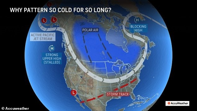


This one could send temperatures plunging even lower than they will this week, but it should be followed by a slow warm up that could last well into February.
‘Until then, consumers will need to continue to shell out dearly for heating their homes and businesses, and most people spending time outdoors will need to have multiple thick layers of clothes to keep warm,’ AccuWeather advised.
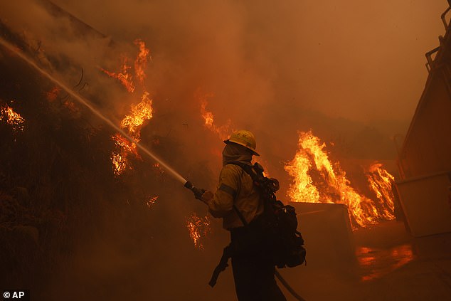
The West is battling a very different surge of severe weather, as Los Angeles grapples with one of the largest and deadliest wildfire catastrophes in California’s history.
The blazes first ignited on January 7 after powerful Santa Ana winds began blasting Southern California with gusts up to 100 mph.
The fires have since burned over 40,000 acres, forced some 150,000 people to evacuate and killed 24.
Their cause remains under investigation, but the winds are what have allowed them to rapidly spread devastation across Los Angeles county.
While the winds have died down for now, firefighters are scrambling to gain better containment of three active blazes before they pick back up starting Monday.
Wind gusts of up to 70 mph are forecast between 4am Tuesday and 12pm Wednesday. NWS officials have stated these winds could be strong enough to cause ‘explosive fire growth.’
A Particularly Dangerous Situation (PDS) red flag warning is in place for parts of Los Angeles county through Wednesday.
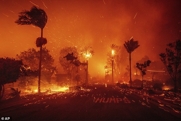
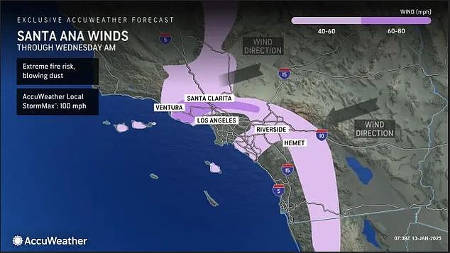
‘This will be a time period of locally damaging winds with extremely critical fire weather conditions,’ the agency’s Sunday advisory reads.
‘I know you want to get back in your houses, and we’re coming up with plans to do that, but we keep getting stalled by mother nature,’ Joe Everett, assistant chief of the Los Angeles Fire Department, told reporters at a Sunday evening briefing.
What’s more, the resurgence of high winds has prompted California’s South Coast Air Quality Management District to issue a windblown dust advisory through 12pm Tuesday. This advisory covers Los Angeles, Orange and Riverside counties.
High winds may disperse toxic ash and dust from the wildfires that could result in air quality levels that are unhealthy for sensitive groups, according to the department.
California authorities are cautiously optimistic that some displaced residents may be able to return to their homes later this week as the winds and high temperatures die down.

